• Skip to main content
  • Skip to primary sidebar
  • Skip to footer
  • Corporate News
  • Generation
  • Oil & Gas
  • Regulation
  • Renewable
    • Climate
    • Solar
    • Wind
  • Storage
  • Tech
  • T & D
Energy News Desk Logo

Energy News Desk

Energy News and Data

Wind Experts Devise Solution for Lidar in Complex Terrain

January 7, 2021 by NA Windpower

ZX Lidars recently partnered with Deutsche WindGuard and ZephyScience to roll out the ZX Complex Flow Solver (ZX CFS) tool, enabling the standalone use of wind lidar ZX 300 in complex terrain.

Based on computational fluid dynamics (CFD), ZX CFS identifies, quantifies and resolves the relative differences between lidar and cup anemometer measurements witnessed in complex terrain.

“While standalone lidar measurements in flat terrain have already had a high acceptance in the past, we see the particular challenges of standalone measurements in complex terrain well addressed and appropriately treated with the ZX CFS application,” says Johannes Cordes, a wind and data analyst on Deutsche WindGuard’s wind resource assessment team. “The design and structure of this service provides the best available solution for bankable wind resource and energy yield assessment based on standalone lidar in complex terrain.”

The CFS algorithm developed by Deutsche WindGuard is optimized for ZX Lidars’ wind field reconstruction. Incorporating results from a high-resolution CFD model, it derives a set of conversion factors. Applied to the volume-based wind data from the ZX 300 lidar, which samples 50 measurement points per second, these conversion factors produce single point measurements equivalent to those of a cup anemometer installed at the same location.  ZX CFS also provides guidance on where to install the lidar initially to achieve the lowest possible uncertainties.

The companies note that cloud computing delivers fast, transparent and accurate results, and uncertainties associated to inhomogeneous flow conditions within the measurement volume can thus be reduced significantly. This widens the usability of ZX 300 wind lidar standalone deployments for wind resource assessments in complex terrain with no additional on-site met mast.

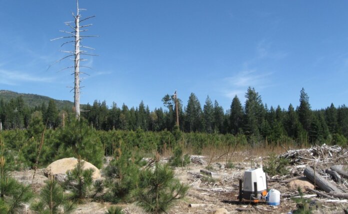
Photo: Lidar measurement in complex terrain; Courtesy of ZX Lidars

Original source: North American Wind Power
Filed Under: Renewable, Wind

Primary Sidebar

Join The Daily Charge

This week's top 5 stories in your inbox. No spam ever.

Trending

  • This Arkansas school turned solar savings into better teacher pay
  • Crowley, Watco Partner to Provide Offshore Wind Management Solutions
  • New Golden Spiral Wind Turbine Proves Concept in Wind Test
  • Silfab Solar Launches New Line of Back-Contact PV Modules
  • PV-ezRack Launches High-Rise Solar Mounting Solution
  • Thompson Unveils Bill Utilizing Tax Code to Combat Climate Change
  • Siemens Gamesa Secures 10-Year Service Deal
  • Orsted, PGE Partner on Baltic Sea Offshore Wind Projects
  • The National Science Foundation Funds Study to Better Understand DERs
  • eia.gov logo EIA's AEO2021 shows U.S. energy-related CO2 emissions rising after the mid-2030s

Footer

Trending

  • This Arkansas school turned solar savings into better teacher pay
  • Crowley, Watco Partner to Provide Offshore Wind Management Solutions
  • New Golden Spiral Wind Turbine Proves Concept in Wind Test
  • Silfab Solar Launches New Line of Back-Contact PV Modules
  • PV-ezRack Launches High-Rise Solar Mounting Solution

Recent

  • Stem Provides Smart Energy Storage Solutions to Today’s Power
  • EIA's AEO2021 shows U.S. energy-related CO2 emissions rising after the mid-2030s
  • Homeowners associations still a barrier for some would-be solar customers
  • Commentary: With open standards, U.S. can build EV charging infrastructure faster
  • Vestas Unveils 15 MW Offshore Wind Turbine

Search

Contact Us

Write For Us

  • Email
  • Facebook
  • Twitter

Copyright © 2021 · EnergyNewsDesk.com