Loveland Innovations, maker of IMGING, a site survey solution created for the solar industry, has unveiled a new suite of shading analysis tools for the platform.
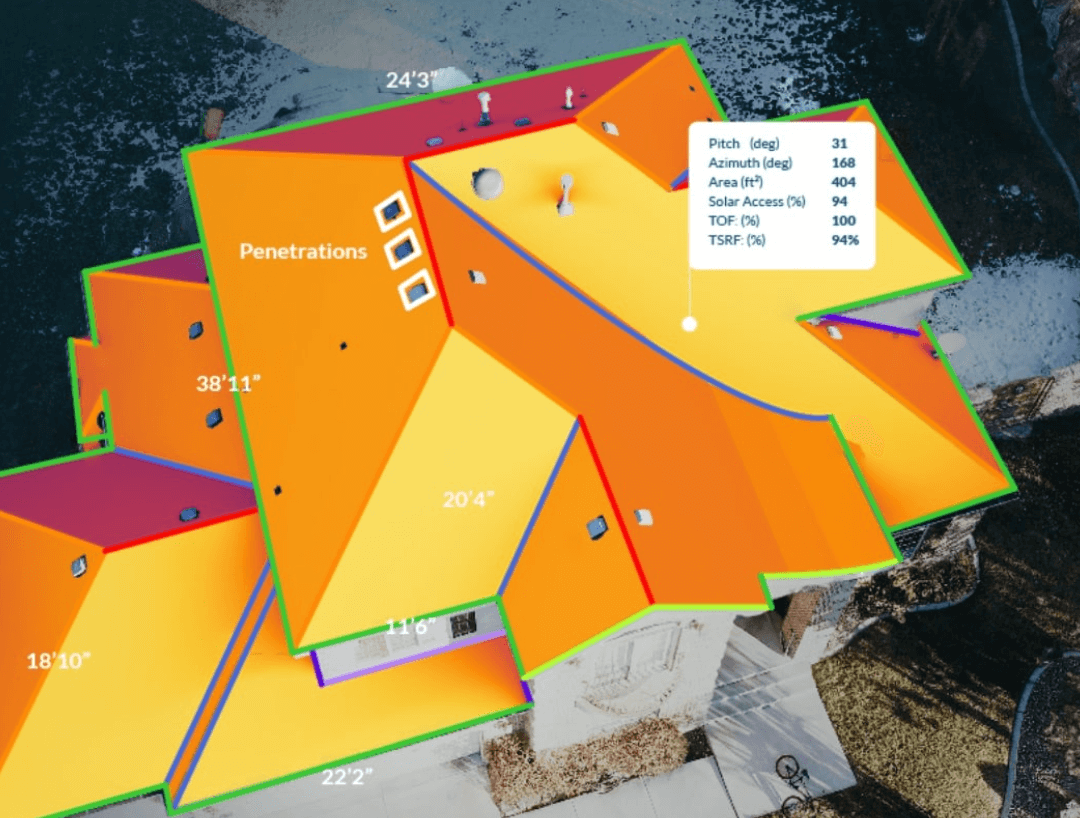
IMGING keeps surveyors on the ground and significantly reduces time spent on site. With a single automated drone flight, design teams can receive solar access, TOF and TSRF calculations – in addition to existing CAD-ready 3D models, roof penetrations, 360° horizon reports and site documentation data already available. By combining all property data in one tool, Loveland Innovations says IMGING is now centralizing the most accurate, up-to-date property data available for designers, engineers and financiers.
“Every solar installation project requires a specific set of data to ensure project success,” says Jim Loveland, founder and CEO of Loveland Innovations. “With this latest version of IMGING, we are continuing to streamline the property inspection process for solar site surveys by making a solar designer’s data set easier to capture than ever before. Now with full shading analysis, a site surveyor can gather comprehensive property data quickly from the ground in one short visit. Installers already love how IMGING has more than doubled their surveyor productivity – our latest update provides even more data with no additional added time.”
The IMGING platform uses patented drone flight capabilities to automatically capture aerial data – such as roof and horizon imagery – providing designers with near real-time data. With an iOS device running the IMGING app, surveyors can also document critical property characteristics such as attics, service panels and roof condition while organizing them intuitively in the app. After landing, designers anywhere have full cloud access to all of the structure’s ultra-high-res imagery, horizon data, measurements, exportable 3D models and shading data including irradiance heat maps, solar access, TOF and TSRF calculations.